This mapping tool enhances 3D visualization
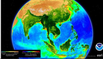
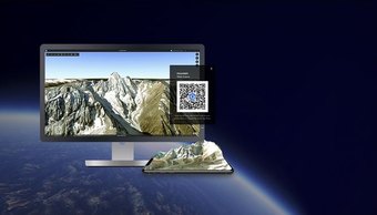
ArcGIS Earth is a free productivity application that allows users to explore and visualize global and local data through an intuitive interface. It provides a consistent experience across desktop and mobile, featuring smooth pinch-and-zoom navigation and easy access to maps, layers, and the Living Atlas of the World.
Explore the world with ease
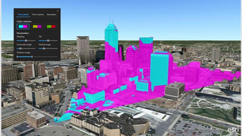
ArcGIS Earth improves administration and authentication, removing the need for mandatory logins. Users can now perform data visualization, measurement, and visual analysis freely, while signed-in users gain access to premium content. These updates make the application more flexible and suitable for both casual viewers and professional users.
While the application simplifies map interaction, it might not meet the deeper needs of those seeking advanced GIS editing. However, with added support for time-enabled KML, users can visualize temporal data using the new time slider, offering greater control and insight when analyzing geospatial trends.
For 3D mapping enthusiasts
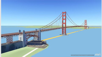
ArcGIS Earth offers a powerful and user-friendly platform for exploring global geographic data in 3D. With simplified access, enhanced tools, and smooth cross-platform functionality, it provides both professionals and learners with an immersive mapping experience ideal for visualization, analysis, and understanding of complex spatial information across multiple environments.